


Chamartín, from the outskirts to the neuralgic centre of Madrid Nuevo Norte
Chamartín Station
When the Chamartín station building (Corrales and Molezún, 1972-1975) was inaugurated in 1975 as Madrid’s new northern station, it was located on the outskirts of the city, beyond Plaza Castilla, which at that time marked the northern boundary of the city.
Today, just 50 years later, Chamartín station is about to replace Atocha as Madrid’s main railway station and to become the new business centre of the Spanish capital: the work underway to transform it into Spain’s most important high-speed rail hub is based on the winning project in the international competition, designed by the engineering firm Esteyco and the architecture studios UNStudio and b720 Arquitectura.
The new Chamartín station will be a multimodal hub for sustainable mobility, connecting Madrid by high-speed train with all Spanish cities and, thanks to its proximity to Madrid Barajas Airport, just 15 minutes away, with all European and global destinations.
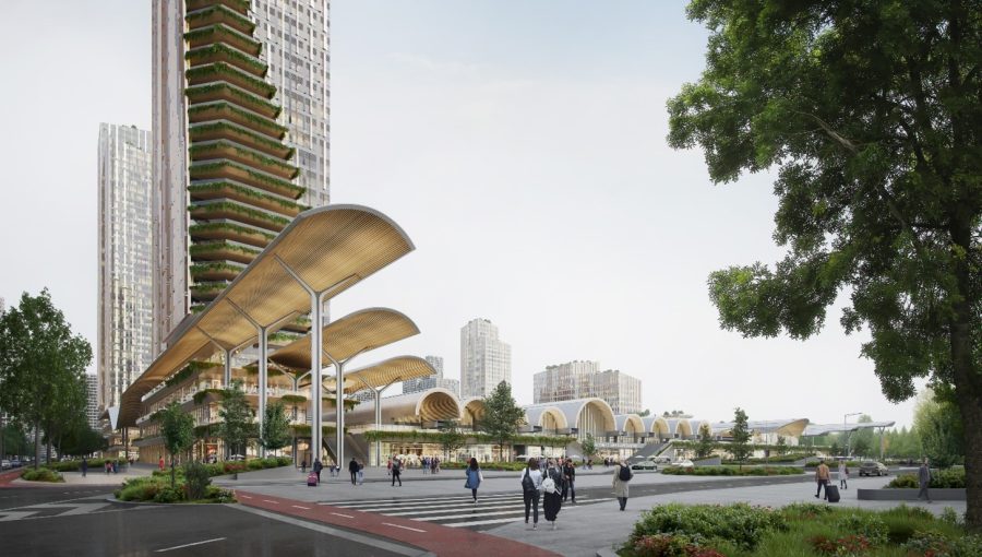
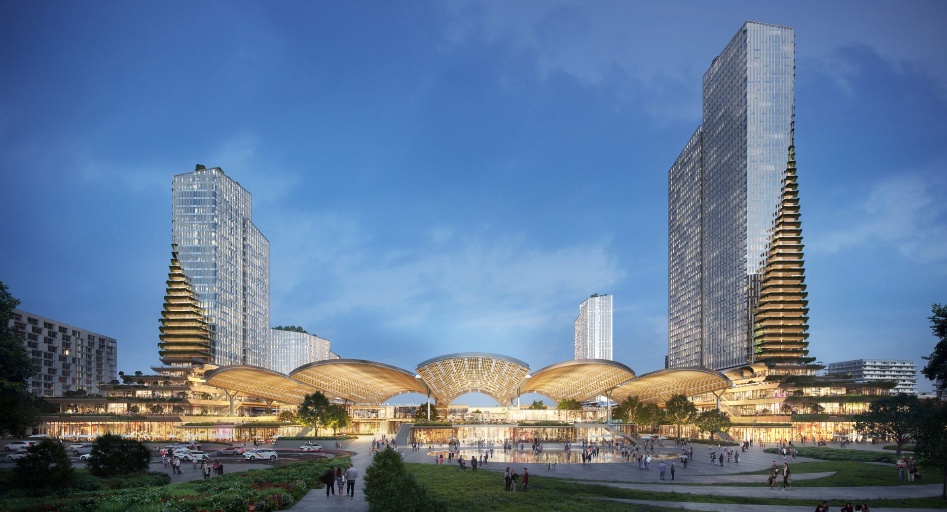
View of the platforms of the new Chamartín railways. 3D infographic provided by ©b720 Arquitectura
Madrid Nuevo Norte
However, the work on Chamartín station is the starting point for a much more ambitious project: It will be the driving force behind the Madrid Nuevo Norte operation, an urban regeneration project covering 5.6 km and an area of 236 hectares of urban land located on both sides of the railway tracks that leave the station heading north.
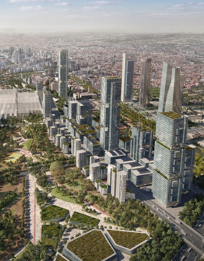
General view of Madrid Nuevo Norte. 3D infographic provided by ©CREA NUEVO NORTE
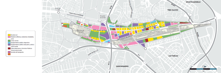
The planned uses. Graphics provided by ©CREA NUEVO NORTE
The original Master Plan for this urban development project was commissioned by its private developers from the firm (RSHP) Rogers Stirk Harbour & Partners and was presented to Madrid City Council as a starting point. Once the project had been defined, a long period of coordination with municipal, regional and state administrations began, along with a process aimed at involving neighbourhood associations from the adjacent neighbourhoods and other local entities. As a result, the current version was finally approved unanimously in May 2020 by the Madrid City Council, 27 years after the initial idea was conceived and three years after the initial genesis of Madrid Nuevo Norte, the final project.

Commercial area Madrid Nuevo Norte. 3D infographic provided by ©CREA NUEVO NORTE
Madrid Nuevo Norte will combine the new business centre, located mainly in high-rise buildings in the area around the new Chamartín station, which occupies 60% of the 2,657, 000 square metres of buildable area, with 10,500 homes located in residential buildings on both sides of the railway tracks in the northern part, and with buildings and facilities for public use spread throughout the Madrid Nuevo Norte area, as well as more than 400,000 m2 of new green areas and gardens.
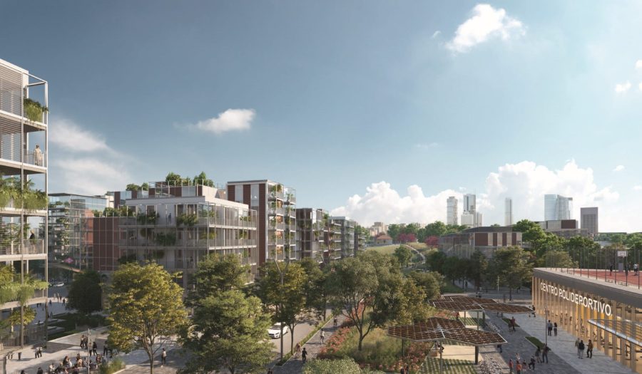
Residential area Madrid Nuevo Norte. 3D infographic provided by ©CREA NUEVO NORTE
The city of the future
Finally, the new city is a space for experimenting with ideas to improve the environmental footprint of Madrid Nuevo Norte: studies are underway to create sustainable urban drainage systems, water regeneration systems that help limit the use of drinking water, studies to exchange cold and heat in district air conditioning plants, and, of course, studies on the widespread implementation of renewable energies and the promotion of sustainable transport. Madrid Nuevo Norte obtained BREEAM and LEED pre-certifications, becoming the first major urban project to achieve both in the design phase.
Inevitably, the construction of Madrid Nuevo Norte and the transformation of Chamartín station will profoundly change the physiognomy of Madrid: the historic and administrative centre located in the southern part of Madrid will be complemented by the new business centre in the north of the city.
Text by: Werner Durrer, MADRIDES
*First picture: General view of the new Chamartín railways stations. 3D infographic provided by ©b720 Arquitectura